
Forward
Four years ago after I completed 11 out of the required 16 miles required to earn the Practical Training Strip, I went straight back to the drawing board.
5 weeks later, I was about to set out on a solo 16-mile backpacking trip on a route whose reviews said it was moderately difficult.
I didn’t get to go on that attempt due to XYZ. And then the pandemic hit and here we are, 4 years later.
First off, those moderately difficult reviews were only moderately right. Also, not only do I understand topo maps now, but I also understand how NOT to take other people’s ranking systems for their face value.
Someone’s moderately difficult trail is someone’s extremely difficult and yet someone else’s walk in the park in my sleep.
So, as you read this log, please understand that my extremely difficult may be just another day for you.
And that’s OK. Because at the end of the day, I finished. I walked passed the last log, into the gravel parking lot, and couldn’t get my pack, boots, and socks off fast enough.
And yes, I am so glad life intervened 4 years ago. I would never have made it. And I am so glad I wasn’t alone this time. I couldn’t have done all 16 of the required miles without my friends.
To some, an overnight backpacking trip is just another 24 hours escaping from reality.
To others, an overnight backpacking trip is life-changing.
I am one of those latter ones.
I am no longer who I was when I first stepped onto that trail Friday afternoon.
So, let’s begin, shall we?
The Log
Location: Gifford Pinchot National Forest, Washington. Situated between Mt. St Helens and Mt. Adams. Part of the Mt, Adams Ranger District
Trail: Quartz Creek Falls Trailhead #5 to Lower Falls Trail #31
Mileage: 16ish (220ish car miles)
Total Trip Time: 33ish hours. 930am Friday to 645pm Saturday
Dates: May 19th to May 20th, 2023
16miler Goal (From Rover Handbook): Plan a trip on foot that will give you a real taste of “frontier days” and that will prove whether you can look after yourself as well as some of your favorite heroes of history or fiction could. Prove you have “First Class Scout ability” to take care of yourself “on the trail,” as an Indian frontiersman or trapper would look after himself.
Log Goal (From Rover Handbook): Report of the hike, paying particular attention to a subject, such as Antiquities, Life and Labor, or Nature Lore. Reports should describe the character of the country seen, the birds and wild animals noted, and should briefly relate all the interesting details and happenings of the journey.
Preface
The place we backpacked is special for so many reasons, and not just because it is an important piece of American history and the fight between settlers and Indigenous tribes. This place is also special because of the power of nature.
My log will not be very bird, wild animal, plant, or trees heavy. I try soaking up all the vegetation knowledge and wisdom that Scrambles and all of my scout/outdoorsy friends share with me, but I have come to accept that my brain just cannot retain that type of information. My brain likes history and character and what happened “behind the scenes”, so to speak.
Please note, I am not a history expert, and I am NOT going to cover ALL the facts regarding the history, lore, or people of the area. But I will write about the pieces that stood out to me and the interesting details that shaped the land we traversed.
I am a storyteller, so that is how this log will be written.
I will first share some of the entries I wrote in my scout journal, fill in the blanks, and add some photos. I will weave in how one of the nation’s first national parks changed not only a nation, but how it changed me as well.
And then I will end this log focusing on the historical and cultural significance of the river whose song graced us for 28 hours and what made the Lewis River Trail what it is today. Majestically magical.
Friday, May 19th, 2023
915am

No journal entry. Didn’t even think about writing one. But if I did, the following is probably similar to what I would have written.
Liftoff time! The trip I have dreamed about and planned for the past 4 years is finally here and happening.
I have spent 4 years planning every little detail. Ok, no. That’s a lie. I spent 5 weeks in 2019 planning the idea of this trip, and I have spent the last 6 months planning every single little detail, from backup plans to worst-case scenarios and the pace I wanted to traverse so I could fully enjoy this trip.
I ended up taking charge of this adventure and planned it all.
Which, to be honest, was a little scary. I have never gone backpacking, and I have never planned every detail of one. All the way up to Saturday evening when I got home, I was still waiting for the proverbial other shoe to drop when something I planned went completely wrong, throwing our adventure into chaos and disaster.
So, a note to the wise: if it’s your first time, ALWAYS go backpacking with people who have done it before. And always get confirmation of trip details from a human who knows their stuff.
You do not want to be learning AND trying to survive to the last mile on grit alone.
You want to survive the last mile with friends who care unconditionally as the lesson you are learning doesn’t turn into an emergency.
Did you know that Lewis River was not actually named after Lewis & Clark? Nope. They sailed right on by, completely overlooking where the Lewis River merges with the Columbia River.
Originating from Adams Glacier and basin on Mt. Adams, Lewis River was originally called Cathlapotle by the Chinook Indians whose main village and trading post was located near the mouth of the Columbia River.
At least, it was known as Cathlapotle until the 1850s, when the first European settler arrived and became the first county surveyor in 1856 after working with Hudson Bay tending to cattle in the Lewis River Valley. In 1929, Lewis River was made official by the U.S. Board of Geographic Names.
Because of his position and importance, the river became a source of being able to trade more efficiently. This led to more settlers, the addition of a ferry crossing, a trading post, a post office, and, eventually, steamboats started carrying supplies and passengers up and down the river.
Whether it was because of his role as surveyor, or his importance in the establishment of Woodland in 1881 – originally home to the Cowlitz Indians – the Lewis River was named after Aldolphus Le Lewes (Adolphus Lee Lewis). As was Lewis River Valley, Lewisville, and Lewisville Park.
Fascinating.
Anyway, as I arrived at Scrambles house where my 3 knowledgeable backpacking friends waited for their ride, all the last anxieties I had about wondering where this trip would all go wrong, left. Mostly.
I trusted those 3 people with my life before they got in the car, and 33 hours later, I couldn’t imagine a better crew on my first overnighter in the wild, dispersed under the stars, under the trees.
1213pm

Excerpt from my journal: “We have arrived at the trailhead. An owl has been spotted. And a lot of bumps had. Very humid. Hear the water running. Can’t wait!”
Clearly, I was super excited to just get started. This was my shortest entry.
We drove up I-5N to WA-502, where we went left on WA-503 when we got to Battle Ground, WA. We drove past some really small towns like Lewisville and Amboy before making our first stop at the Mount St. Helens National Volcanic Monument Headquarters in Amboy.
I wanted to stop here first so I could purchase the correct map of the area we were going to because I love maps and I love having something to reference while in the woods. I didn’t bring any chargers because I cannot rely on my solar chargers. Something I need to remedy eventually.
Narrator: At some point Friday evening, Kelly suddenly realized that she left the map in the car, and then chuckled. If this was the worst thing to happen, she could deal.
The two ladies womaning the station were amazing and super helpful. We laughed about how ridiculously large and frustrating they are to close.
We grabbed some stickers and free “prevent wildfires” bracelets for our kids back home, and Scrambles and Bowline both grabbed a copy of the Smokey Bear sheet music. Bowline graced us with his amazing singing voice till we reached the small town of Yale. Side note: I regret not grabbing a copy for myself. I can remedy that easily though.
Before joining the section of WA-503 that originated in Woodland, WA, we had to cross Yale Bridge, a single-lane bridge that crossed the section of Lewis River between Lake Merwin ![]() and Yale Lake (E).
and Yale Lake (E).
The Yale Dam on Yale Lake, a 323-foot high earth-type hydroelectric dam, opened in 1953 with a capacity of 134 megawatts that can power 22(ish) thousand homes. I figured that out by math but don’t ask me what an earth-type hydroelectric dam is.
It is reported that Yale Bridge, and consequently Yale Lake and the community of Yale, were named after Yale University, the only higher education facility to teach a forestry program, dubbed Yale Forest School (changed in 2020 to Yale School of Forestry & Environmental Studies) in 1900. All thanks to a persistent man named Gifford Pinchot.
I am not going to go into the man, the myth, the legend – Gifford Pinchot – because I would not be able to do him justice. Click on this link to learn more.
Basically, he was the “First Chief of the Forest Service” and played an integral part in shaping early environmental awareness and why forests are managed. Whether you like the man or not, his perseverance ensures our forests are protected and healthy.
The rest of the drive was uneventful as we continued N/NW through the small town of Cougar, which had a bar that did not look friendly, a resort, and a store with creative signage out front alerting to all things one would want when camping – ice and ice cream. Duh. (pics are blurry because I was in a moving car, not driving).
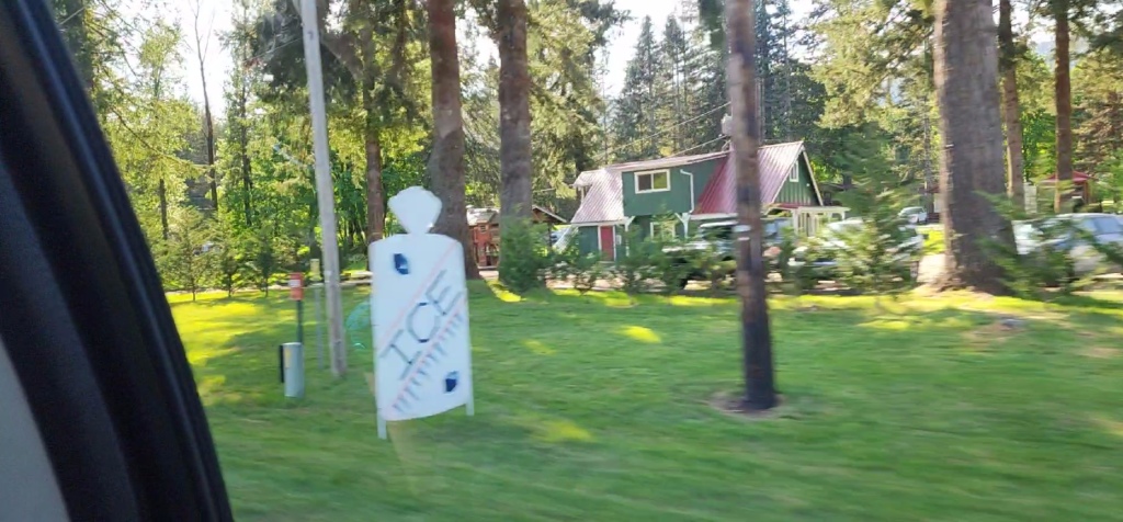

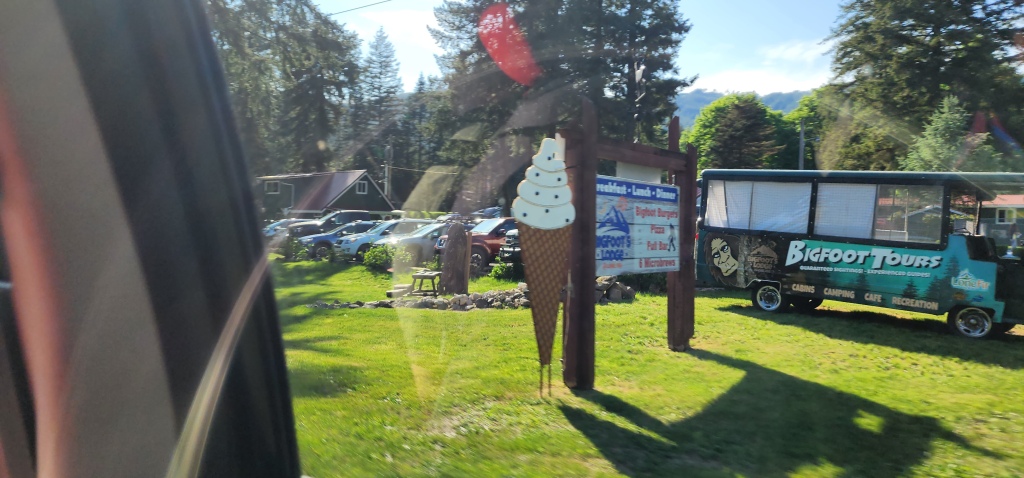
I even spotted a quick glance of Bigfoot seated outside waiting patiently for campers and passersby. Pretty sure it was a wood-carved statue but we didn’t stop to make sure.
A few miles past Cougar, WA-503 turned into Rd No 90, and then I blinked and we entered the Gifford Pinchot National Forest, where Rd No 90 turned into NF-90.
The road was windy as the Swift Reservoir graced us to our right.
Only a few houses existed here and there. But before we turned off NF-90, or rather Hwy 90 as it is referenced at this point, we did pass another ranger station. We could have stopped at this one. But, honestly, I found directions to the first one that popped up on google maps.
After passing Pine Creek Information Center, we took a right-hand turn onto FS-90 (AKA NF-90). We passed the teeny town of Northwoods, which is reported to not have any electricity. Each residence in this community of 206 cabins must use propane or generate their own electricity somehow. It is also said that cell phone reception arrived in this small community less than 10 years ago.
As you drive through Northwoods, there are signs alerting travelers to one of the only stores for miles – Eagle Cliff Store – where they have ice, beer, and showers. Priorities.
But don’t blink because you will miss it.
I did.
As we left the community of Northwoods, we entered the Gifford Pinchot National Forest once again. With Lewis River on our left now, we continued north on some very windy, bumpy roads. There was one 3 to 5 mile long section that was unpaved. Some of those dips were extremely hard to see with how the shadows hit the road. Let’s just say, the suspension on Ruby Lue, my Red Subaru, got a workout.
At one point, a giant bird with their wingspan wide flew in front of us and landed in a tree. I slowed as fast as I could, but I stopped right past and couldn’t get a good photo. I do know that I did look at it as I was slowing down, and those large dark eyes bore a hole into my soul.
That was when Scrambles told us that it is said to be a good omen to see a Owl at the beginning of your journey.
I checked just now and, while I never doubted her, I was curious. And yes. According to many cultures, owls symbolize wisdom and mystery, but also danger. Mythology reasons that seeing an owl can be a good OR bad omen, depending on the situation. Either it is telling you to rely on your inner wisdom, or there is a tragedy coming soon.
I am glad I was only aware of the good luck they bring at the time. Phew.
Right before Crab Creek Trailhead, we crossed the Lewis River, placing it to the right of us. We then continued and drove past the Lower Lewis River Falls TH, Middle Falls TH, and we almost drove past the Quartz Creek TH.
Thankfully, the AllTrails maps I had downloaded showed we were at the right place.
We parked, turned off the car, opened our doors, and was immediately hit with humidity. It was about 85*, sunny, blue skies, and only 42% ish humidity, yet I started sweating before I even stepped on the trail.


135pm
Excerpt from my journal: “Eating lunch at bottom of upper falls. Across bridge saw a butterfly. super tricky downhill spot – Bowline lent me a hiking pole to use. Phew.”

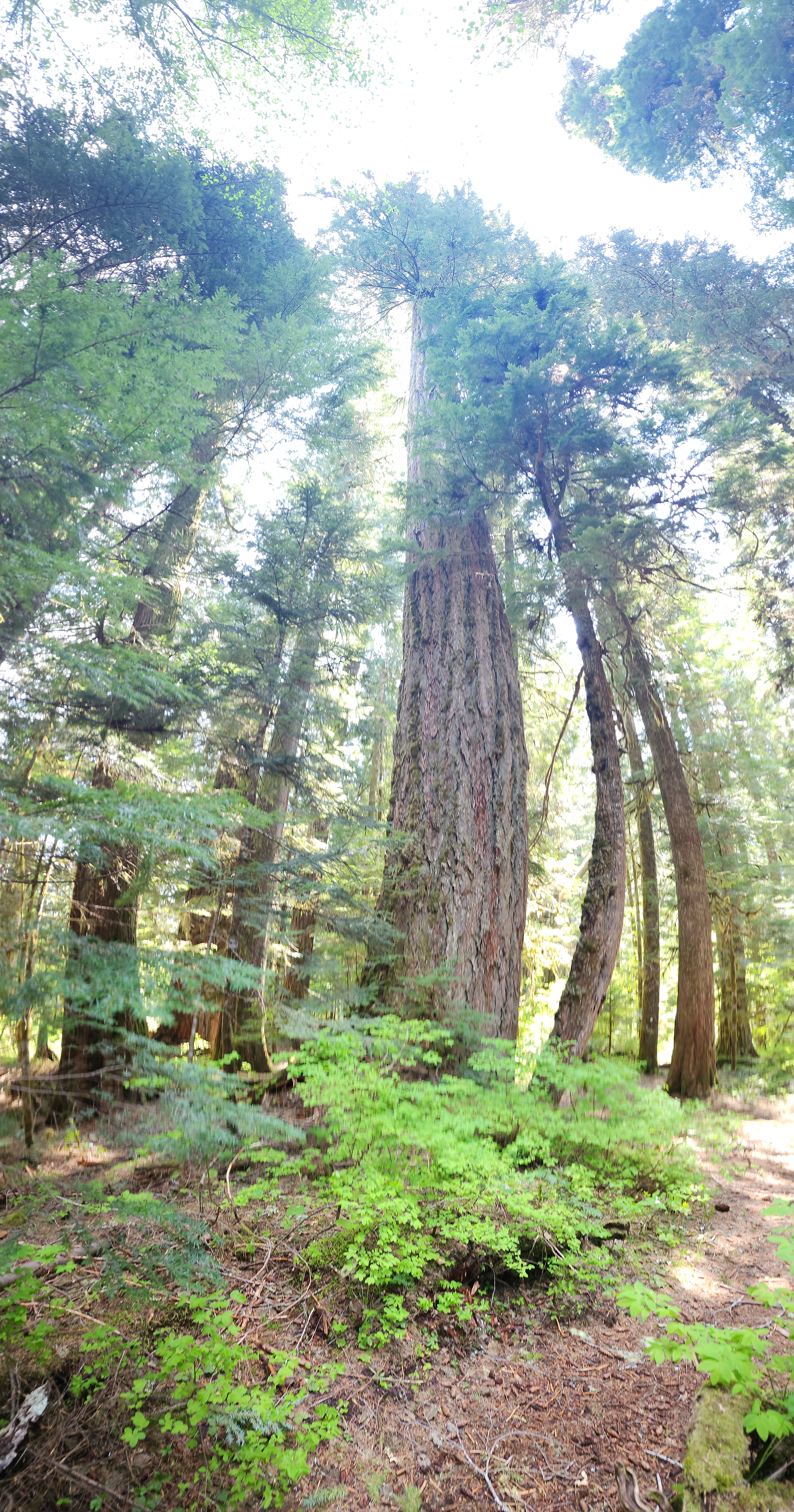
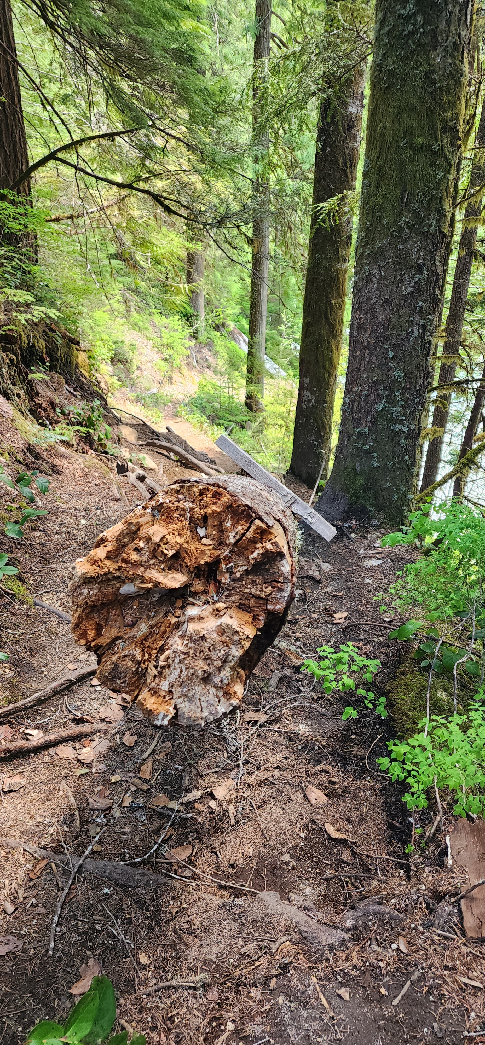
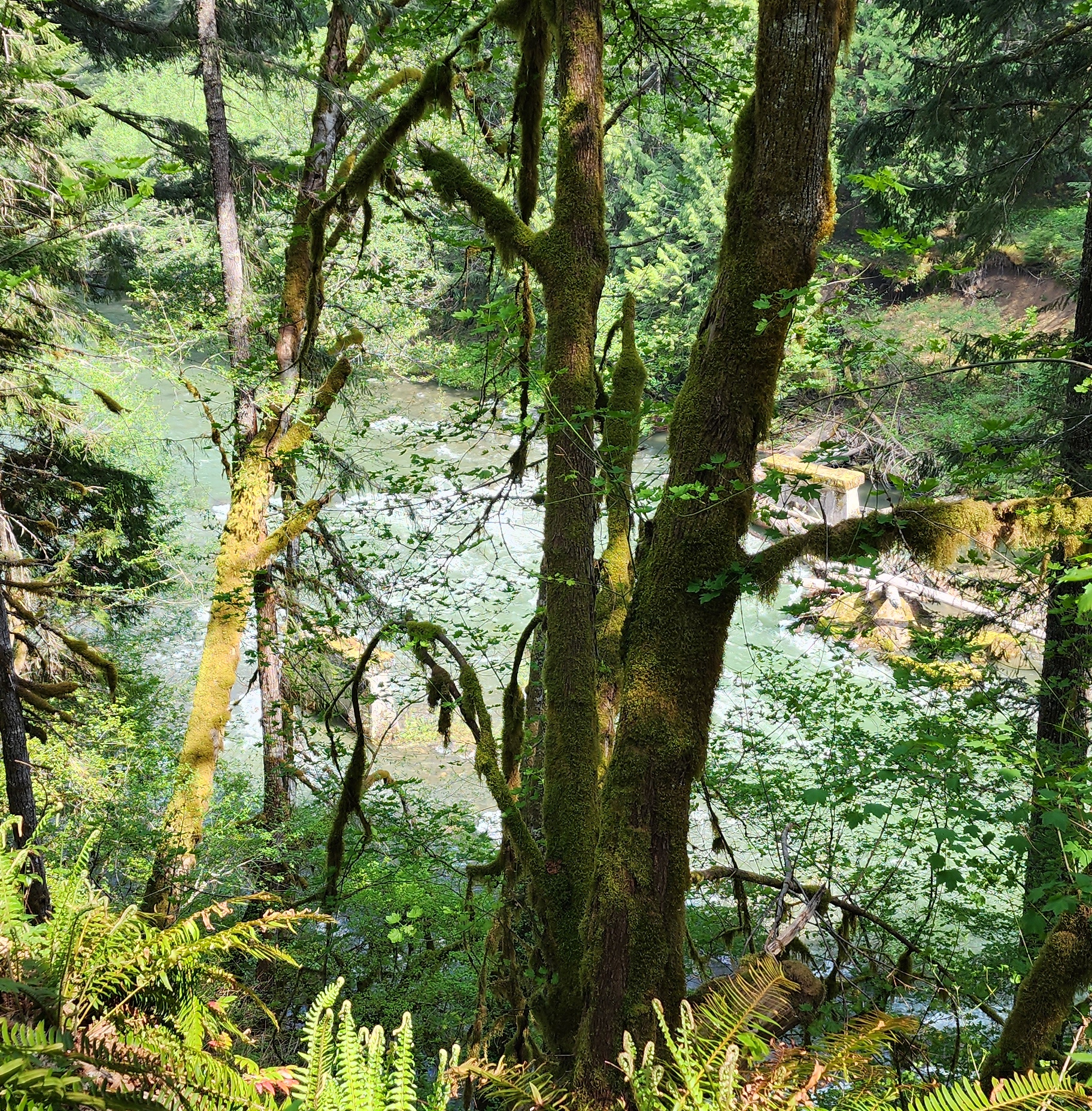
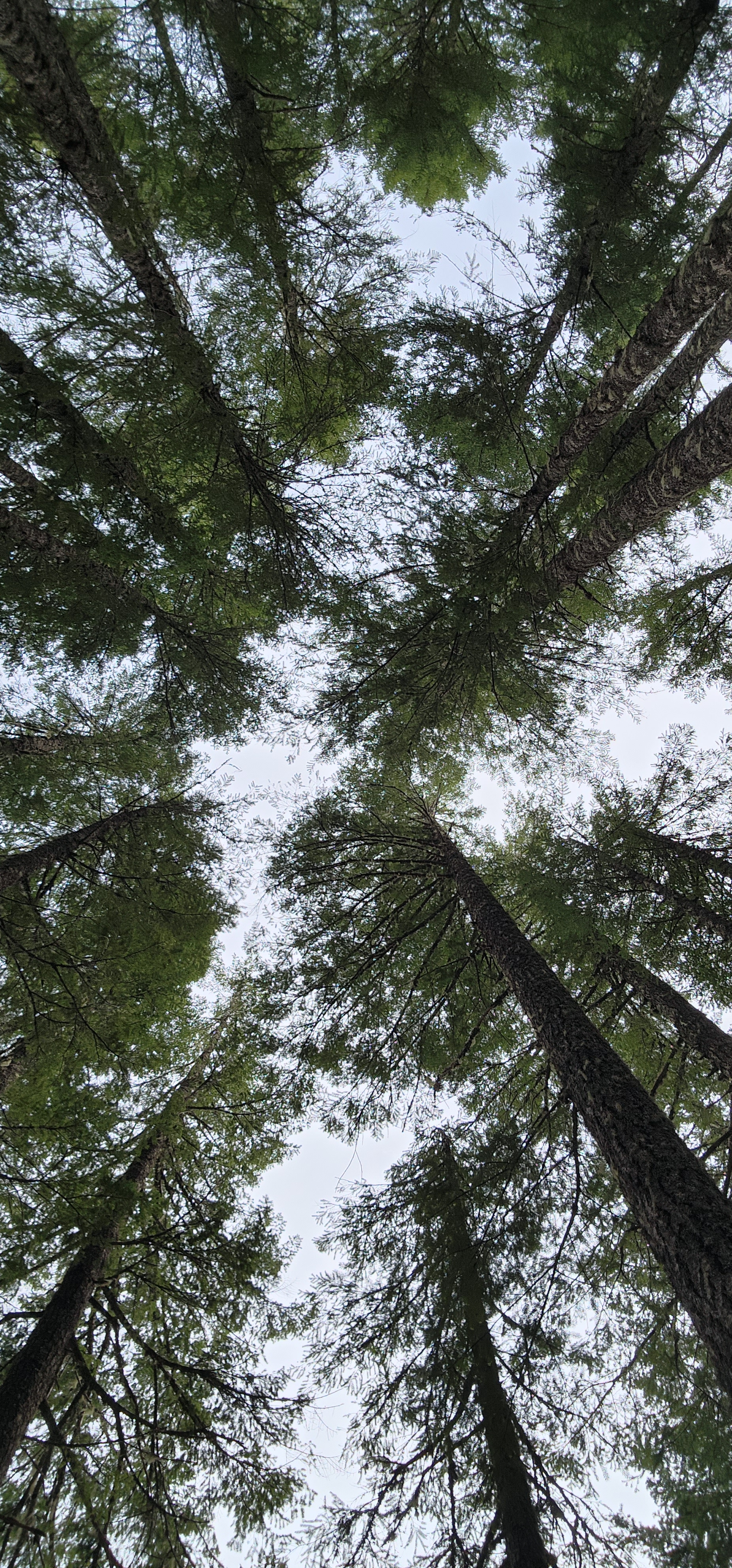
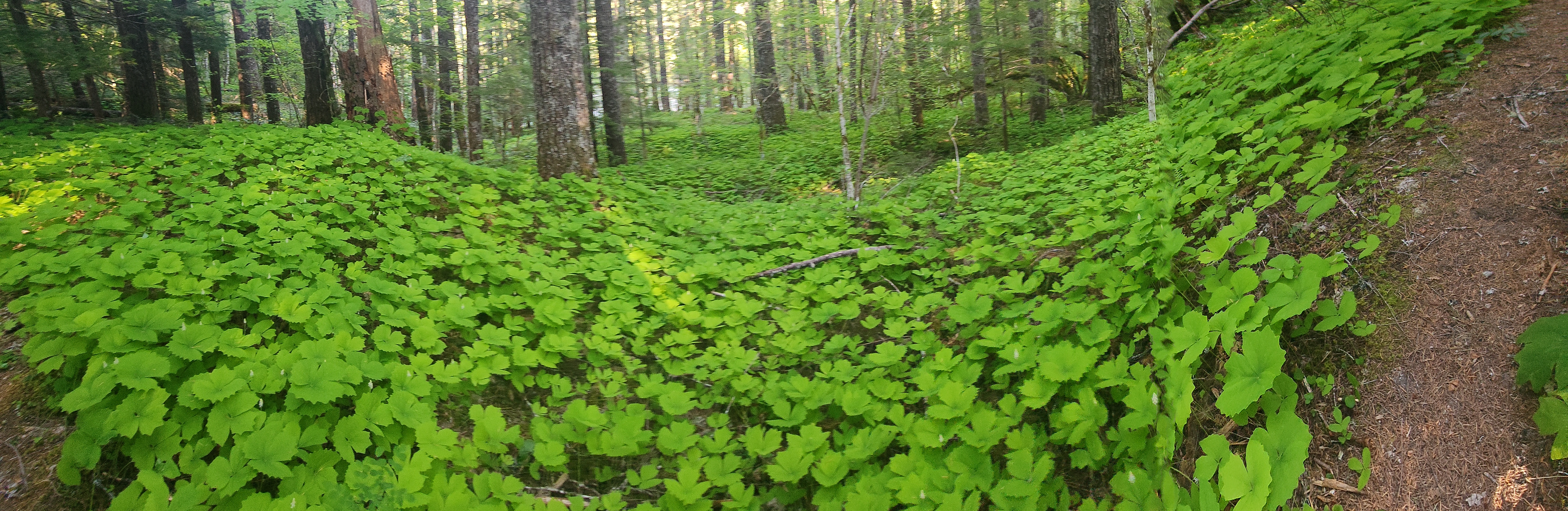
And, we were off! The first part of this trail was in a forest of old growth, Yew trees, Douglas Firs, and vegetation of all shades of green that I couldn’t tell you what was what, but it was gorgeous.
Even the freshly dead trees.


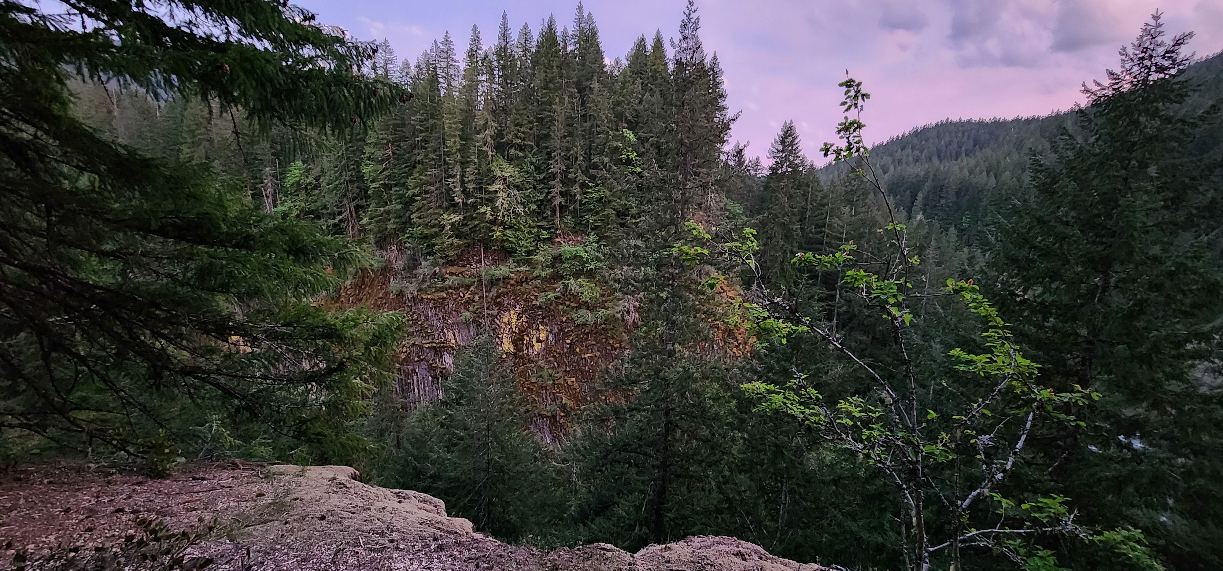
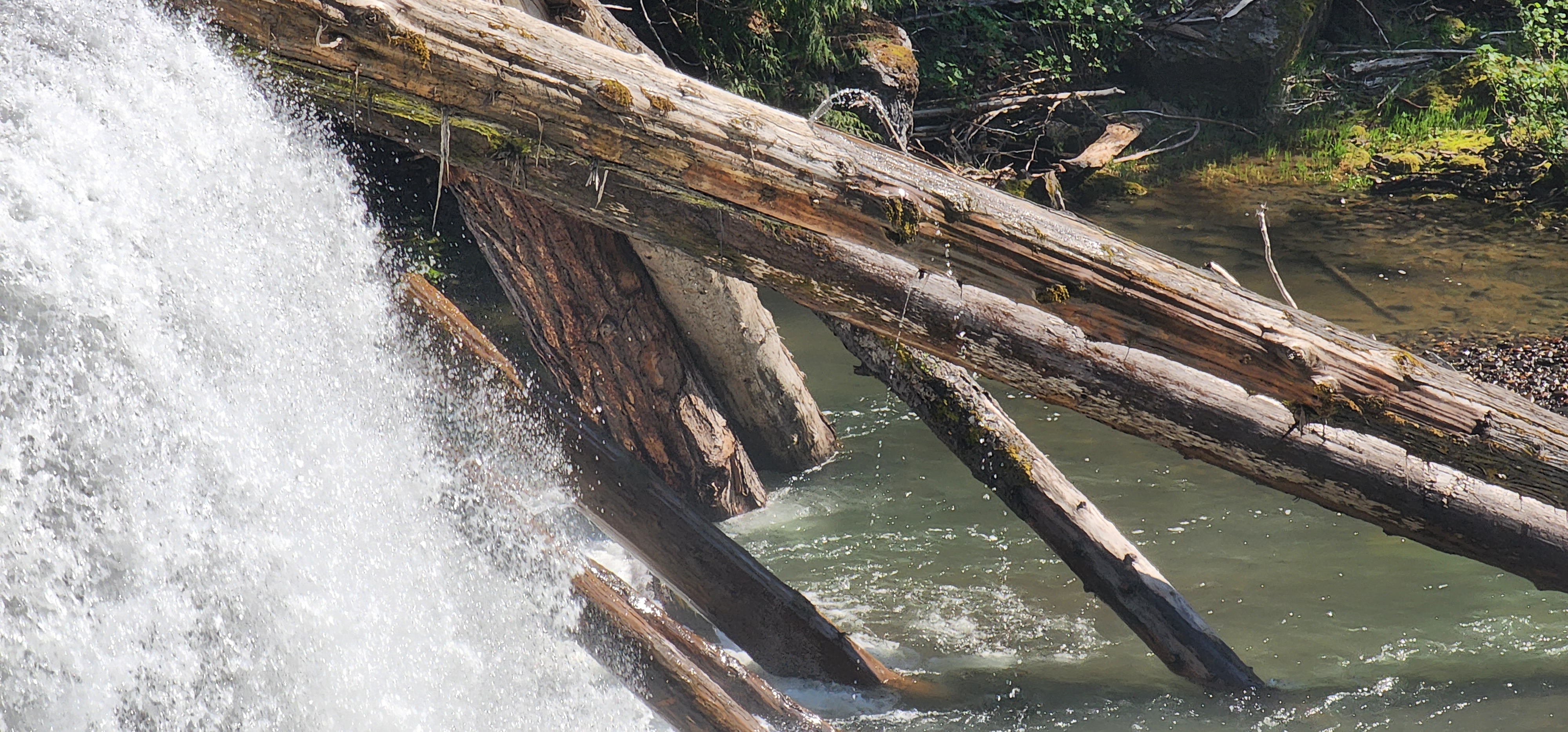
With Quartz Creek to our left, before we turned right to hike south along the Lewis River trail, we saw a pretty big log jam. We wondered if they have been accumulating over time, or if they were from the eruption of Mt. St. Helens in 1980. Regardless, it was a “wow” sight from afar. Definitely not a safe place to practice log rolling. Not that I had that thought…

Right before that view, we crossed paths with another hiker. We all commented on how humid it was, but this wonderful stranger told us the mist from the falls was worth it.
So, we continued.
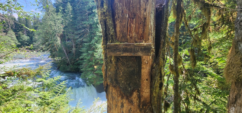
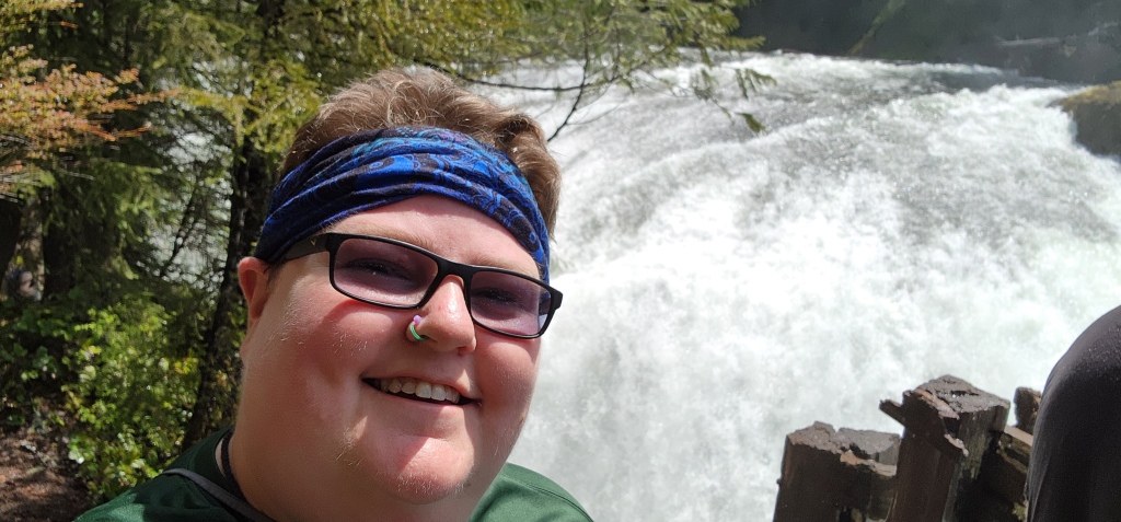
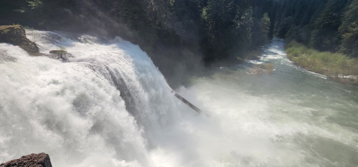
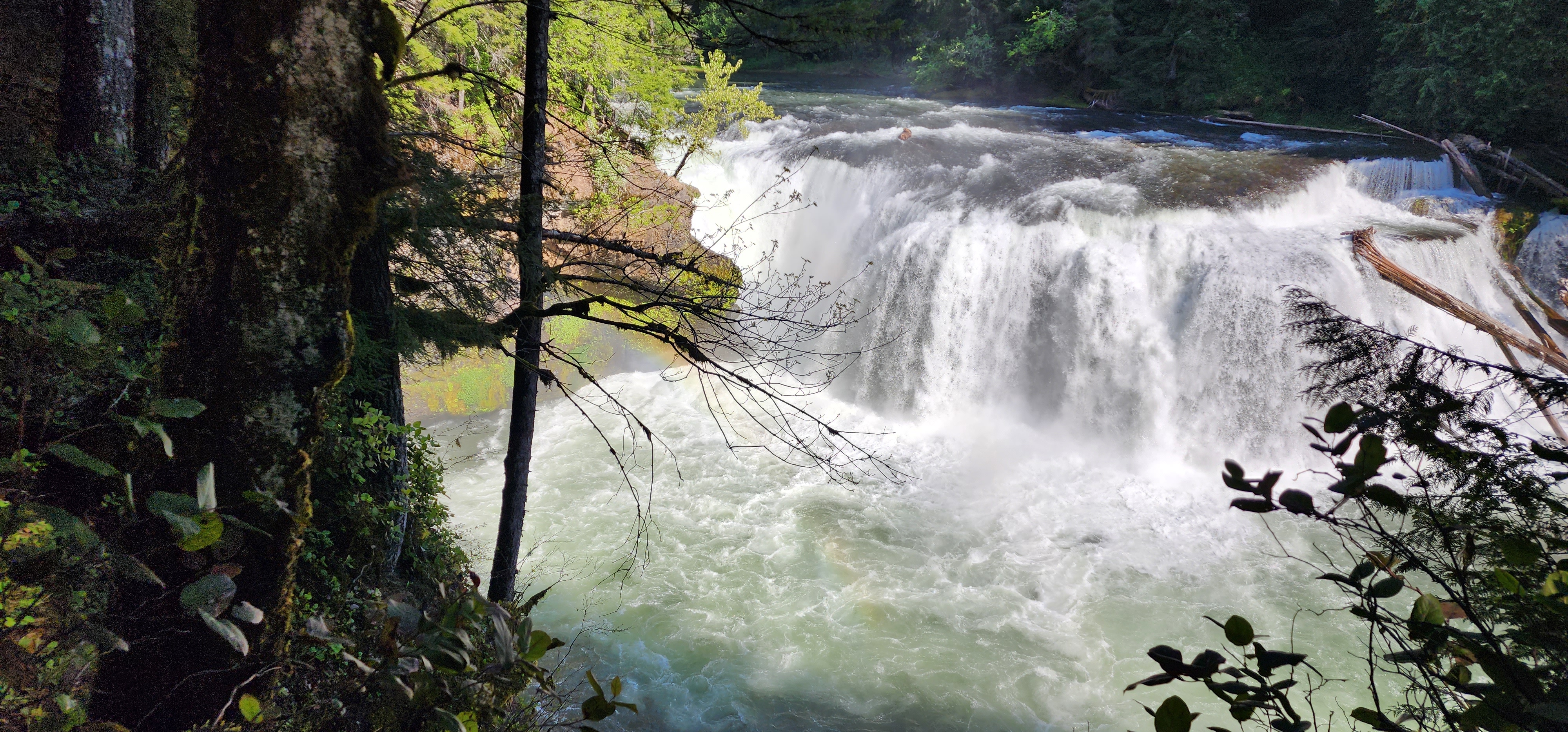
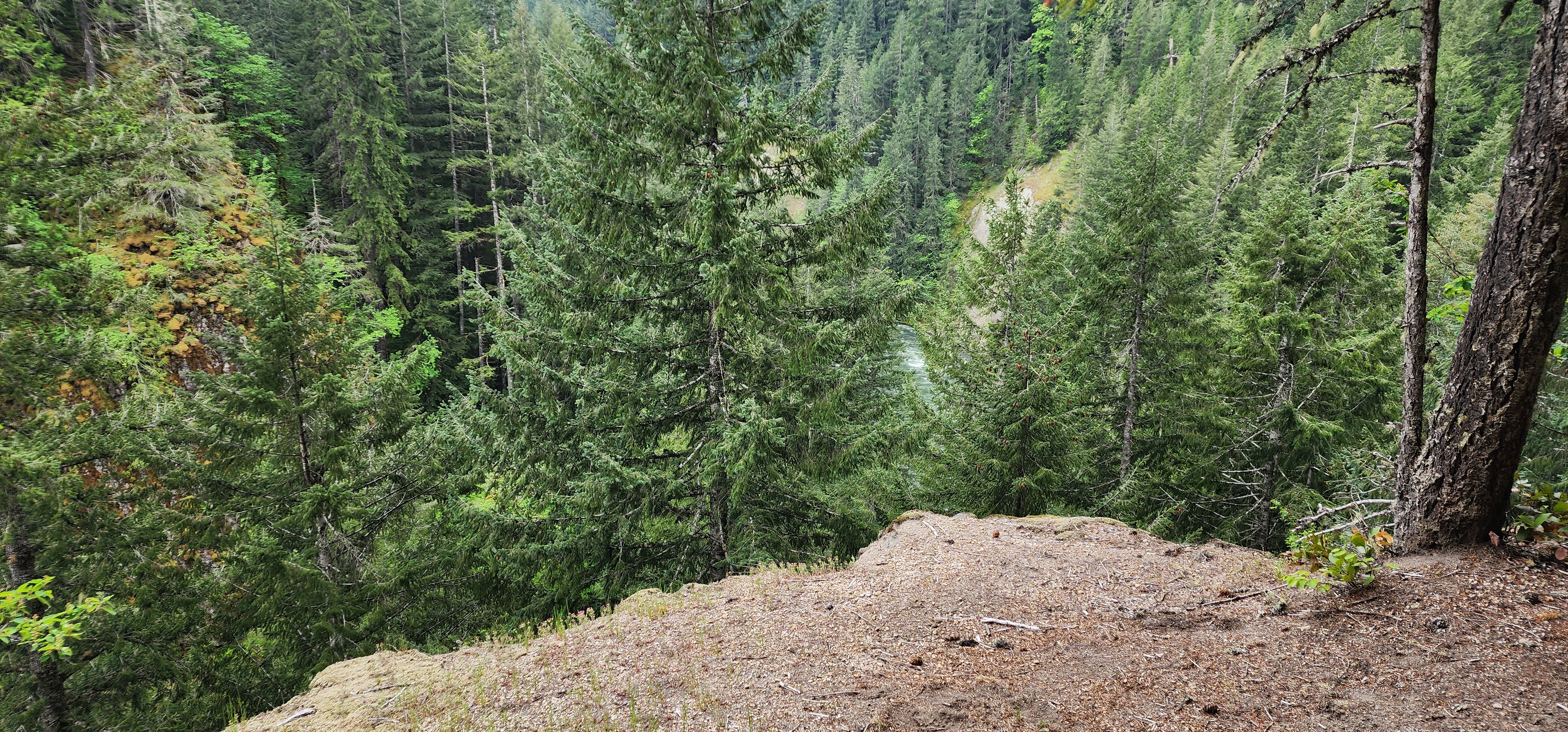
We definitely heard the falls before we saw them. The first falls we saw – the Taitnapum Falls, is 16ft high and often an overlooked falls. I certainly didn’t know it was on this trail. To get a good look at it, there is a tiny side trail to the very edge of the cliff and that’s about it. We took pictures and kept moving.

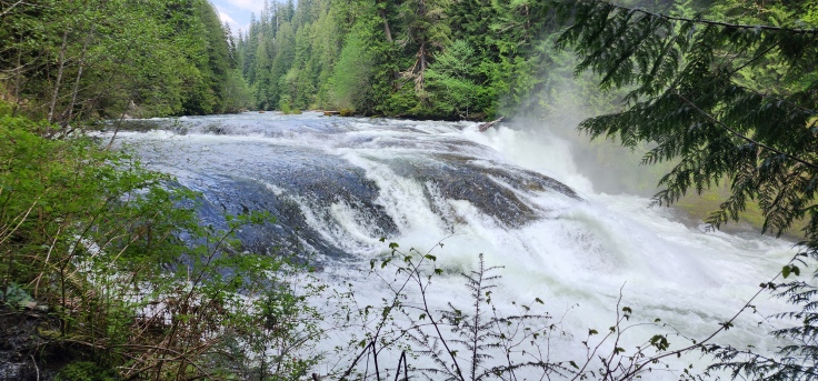
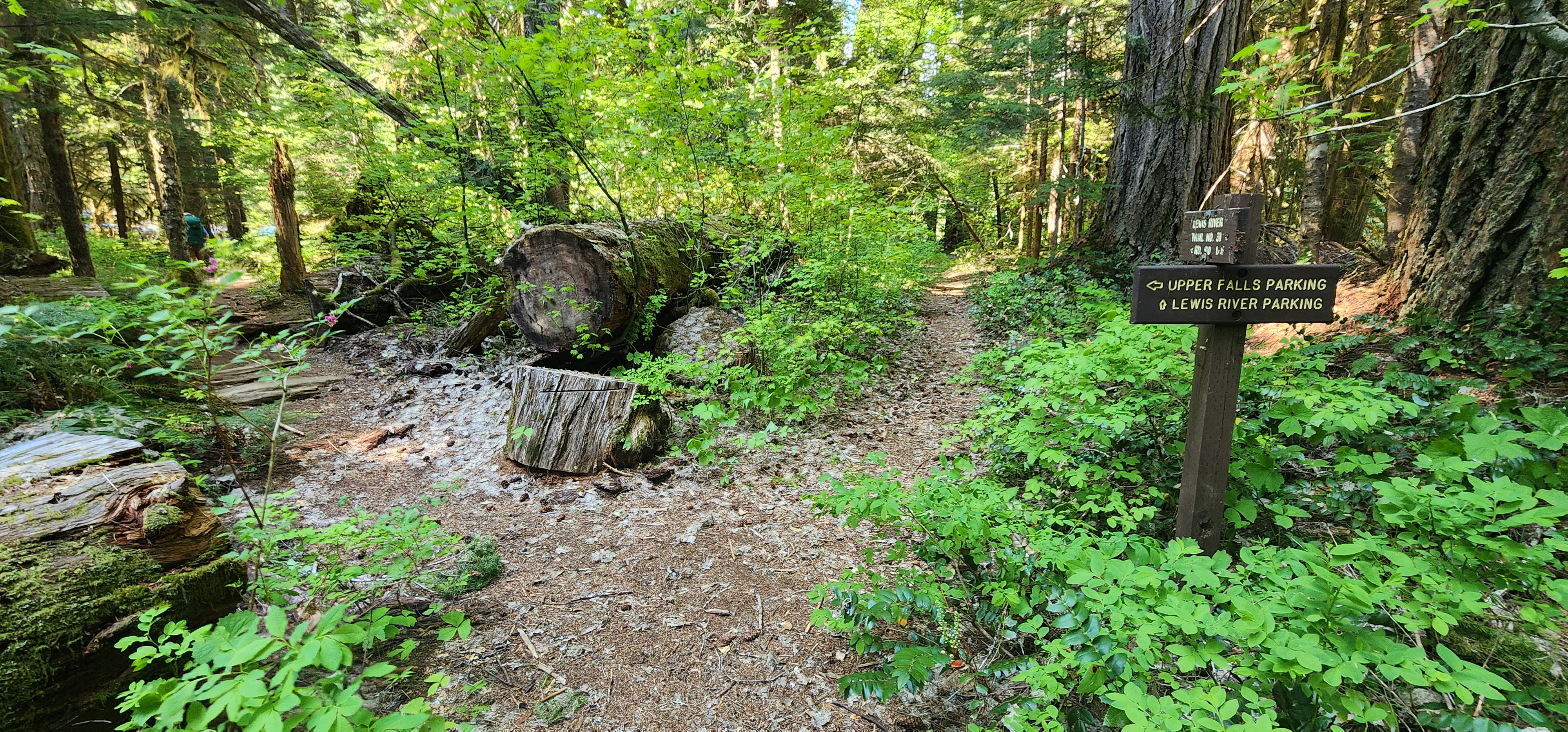
Then, we finally came upon the Upper Falls. At 58 feet tall and 175 feet across, this falls is the tallest of the four Lewis River falls we would be passing.

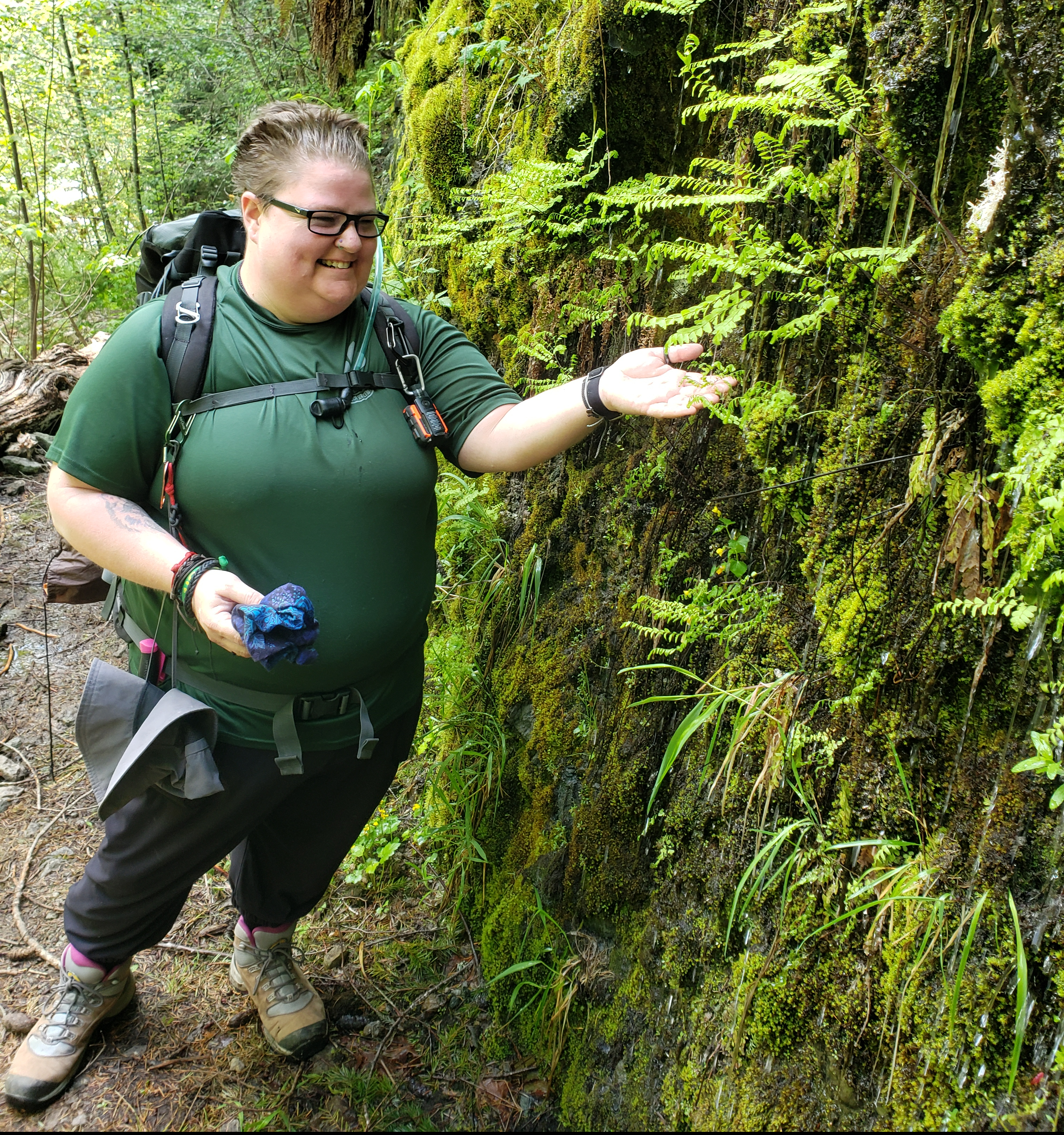
When we arrived to the side trail down to these falls, a tree had fallen across the path. Not being a group of rovers who back down from a challenge, as long as we are safe, we scrambled over the down tree, treaded carefully over uneven terrain, and stepped sturdily so as not to slip on the rocks wet from the mist. And they were wet.

The river being so powerful from melting winter snow on Mt. Adams, meant the mist was constant. And it felt good. So good. A refreshing shower. Definitely worth it. At this time of year, the square basalt floor and steps to a pool at the bottom cannot be seen, but it’s there. Or so I have read in other people’s logs.
Thoroughly cooled off, we hiked back up to where we left our packs at the top in a little corral (probably for mountain bikers), and off we went once again. We followed the path to the right and climbed high. Which meant we had to go back down. Ok. Not a problem.
Until that downhill is covered in shifting sand and loose rock, positioned right next to a wall of rock directly to your left and certain tragedy to the right.

This was the tricky downhill spot. If I haven’t said it enough, THANK YOU SCOUTER BOWLINE!
But, after panicking and contemplating just sliding down on my behind, we finally made it down to a bridge that had us cross Alec Creek. Shortly thereafter, we stopped for lunch at a beautiful spot facing the magnificence of the Upper Falls. As I sat on a large round stump, making my peanut butter tortilla and forcing my heartrate to slow, I tried to soak in as much of the power coming from the falls as I could.


It was at this spot where I learned about Devils Club. Thankfully, I did not learn the hard way. Scrambles warned me before setting off to find a secluded spot to pee. THANK YOU SCOUTER SCRAMBLES. But, it was everywhere at this spot. I was doing some interesting acrobatics to move around and over and under those suckers so I wouldn’t have to learn the hard way.
332pm
Excerpt from my journal: “My fitbit says 6.07mi, AT says 4.63mi. We be stoppin’ by the river for snack and refill waters. I saw a squirrel with a nut. We scared each other. I am cruisin. Kinda just want to get to camp. At least 4mi to go.”
Oh, dear Scouter Beast, how naive and innocent you were at 332pm…
The most interesting thing that happened between Upper Falls lunchtime and Lower Falls snack time, was how a squirrel and I scared each other. When we both looked at each other, the squirrel dropped their nut and I instantly felt guilty.

Ok, so that’s not the most interesting thing.
Before we made it to the Middle Falls, I did see what looked liked the end supports for some sort of bridge. That wider trail definitely made sense then. But it wasn’t until I got home and relooked at my research, that I learned it was actually an old “sheep” bridge. Interesting
We continued onwards and took the side trail down to the Middle Lewis River Falls.

Standing at 33ft high, 300ft long, with a 77* pitch over vertical block forms and sheets of bedroom, plunging straight into a deep horseshoe below that you couldn’t see, but trusted was there, the Middle Falls were just as stunning and powerful as the Upper Falls.
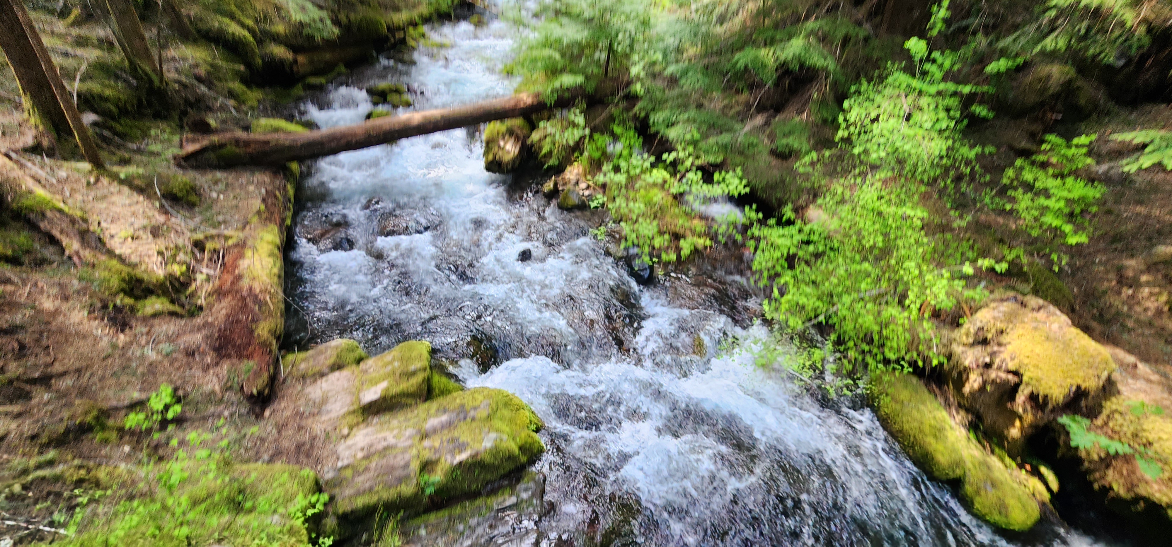
There was another viewpoint to see the Lower Cooper Creek Falls that we were about to cross next, but there was a wooden horse with a “Dead End” sign. So, while curious, I did not explore further.

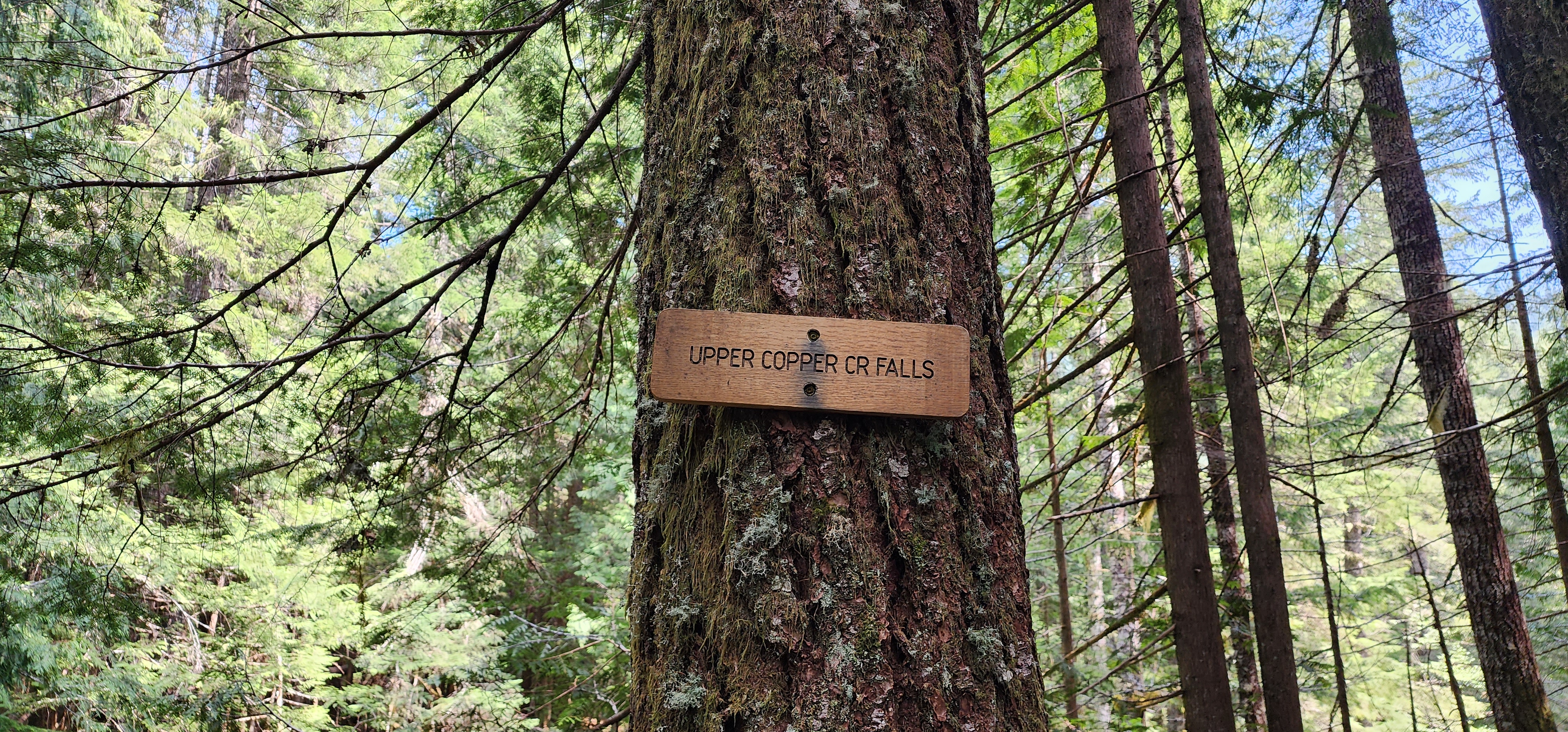
After crossing the bridge that sits atop the Upper Copper Creek Falls on Copper Creek, we stopped for a brief second at the Middle Falls Trailhead to look at the map of where you can and cannot disperse camp.


This was helpful information. In none of my research leading up to this trip, I didn’t know you couldn’t disperse camp within the Lewis River Recreation area until the nice ladies at the ranger station told us earlier.
It took me a while to understand why that would be. It wasn’t until later that evening, when searching for a spot to finally call home for the night, that I understood. Dispersed camping was not allowed in that boundary because there were TONS of spots to disperse camp. And because there were TONS of spots, the traffic and trash that permitting dispersed camping would bring, would tarnish the beauty of the Lewis River Recreation Area.
Anyway, we took advantage of the boundary map at this trailhead to confirm where we could and couldn’t camp for the evening. We are nothing if not respectful of our natural world.
Before reaching Middle Falls trailhead, the trail did open up wider, and we hypothesized that it could have been an old logging road, or the original part of NF-90.
Leaving the Middle Falls TH, the trail was covered in larger rock pieces that was not nearly as hard to navigate downhill as loose sand and pebbles.


As the trail wandered back to the river, we ran across another closed trail. I took a picture. Because curious.

We continued with the river to our right, letting a few faster walkers pass us. I got to experience my first journey on very narrow, sketchy sections, where one step would equal an untimely demise. Needless to say, I moved at my pace and made sure ALL of my feet were planted firmly. It was both exhilarating and scary AF. But we did see some really cool water run off places and some cool snags.
By the time we made it to our Lower Falls stop that was actually just a little bit upriver from the falls, I was ready for a snack, take my pack off for a few, and to use an actual toilet at the Lower Falls Campground.
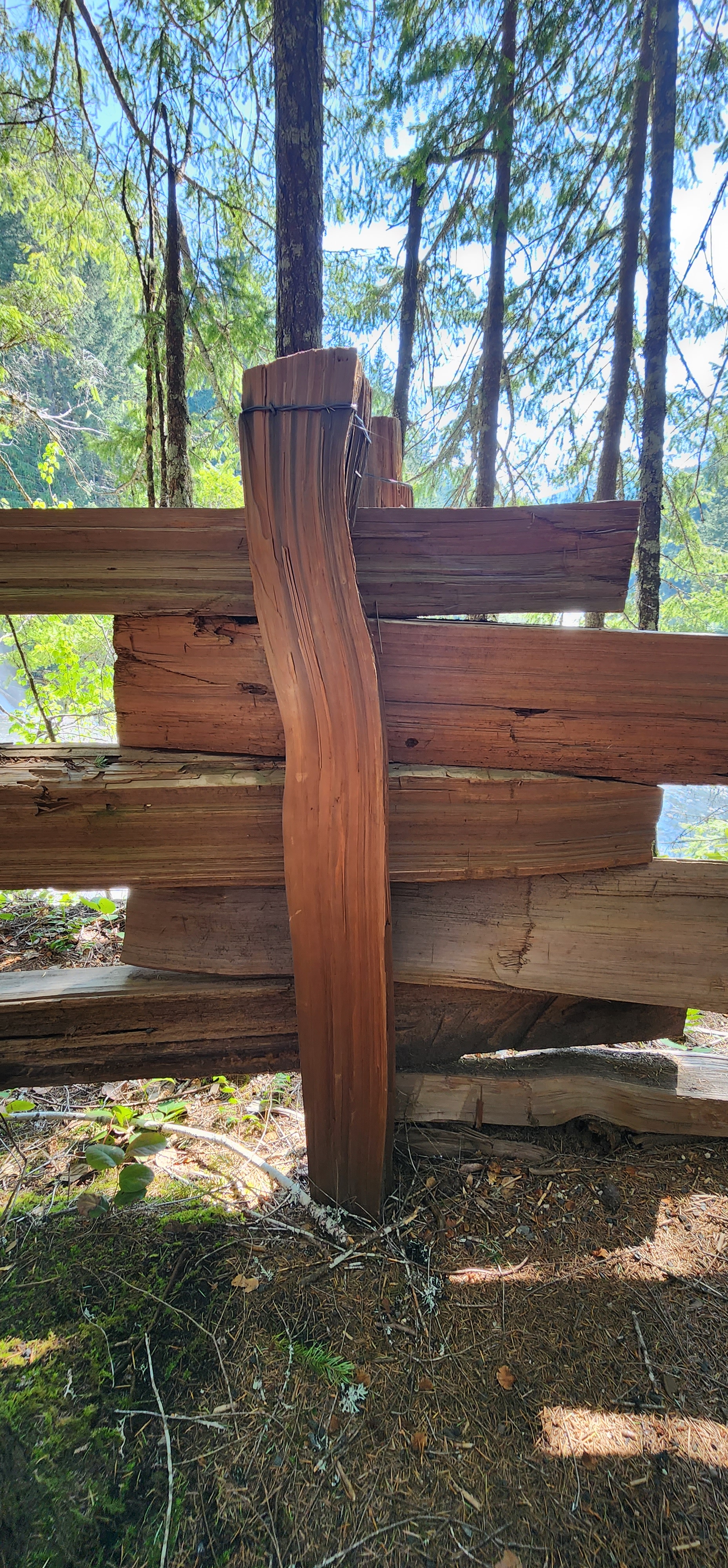
After accomplishing all three goals – snack, sit, bathroom – we finally got to see Lower Lewis Falls, a 200ft wide, vertical block form with a 43ft drop said to have deadly undertows. There were multiple signs warning of the dangers. And one of the coolest wooden fences I have ever seen. Without screws or nails, only metal wire wrapped around the top of the posts, it was primitive and added so much character to the area. At one point, I was curious if this was a method the Indigenous Indians used and that we learned from.

638pm
Excerpt from my journal: “the trail goes on and on my friends. Someone started hiking… I walked across a freaking log across a freaking river! And then I cried. My fitbit says about 10.5mi and AT – 8.46mi. All I know, is I am freaking exhausted.
The place we have stopped is kinda not appropriate but will work. Once I recover. Scrambles and the spouse are trudging forward to see if they see anything else. I am contemplating peeing.”

What an AWESOME entry. In 100 years, they are going to wonder if I ended up peeing or not. (p.s. I did. Eventually).
Anyway, the section between Lower Falls and this stop, was the HARDEST. I had nothing left to give by the time I sat down at this very uncomfortable but manageable spot. I had to dig deeper than ever before. I didn’t even know I could dig as deep as I could.
Shout-out to Scrambles and the spoose for recognizing my gas tank was below empty, that I needed to stop.
After we crossed NF-90 to continue on the Lewis River trail past the Crab Creek TH, the second tricky down hill spot made its appearance. Again, Bowline let me borrow his trekking pole.

When I relooked at the map a couple of days ago, I definitely agreed that this particular river earned its name, “Cursed Hollow Creek”. I already wasn’t looking forward to the return trip. However, the name of this river is actually “Cussed Hollow Creek”, which I just learned, as of this writing, means “stubborn, annoying”. Still fits.
Before The Log, we did walk by a spot that looked like an interesting trail to follow. And if I wasn’t actively dying, I would have obliged Scrambles’ curiosity. This side trail is actually a mountain biking trail named Bluff Trail that is basically just one big giant uphill to NF-93.
The fact that people actually mountain bike this trail astounds me.
A few hours (ok, a few minutes) later, we crossed paths with a couple of fellow backpackers. They sounded as desperate as us when asking if there were any good camping spots behind us/them.
We solemnly broke the news that there wasn’t any, or we would have been setting up camp instead of wondering how I could throw myself off a cliff in the middle of the fields upon fields upon fields of wild Vanilla Leaf.
Narrator: They did, in fact, actually find a spot BEFORE the second tricky downhill spot that I could have avoided…
They, however, had much happier news.
About a mile behind them, there was an epic spot at the top of the hill.
We thanked each other, said bye, and we continued on our ways.
Scrambles, Bowline, the Spoose, and I all made the same exact comment or had the same thought. We didn’t miss when they said “at the top of the hill”
But we also held on tightly to the fact that they said about a mile back. We were ready to eat and get off our feet. Well, I was. At this point, I was e.x.h.a.u.s.t.e.d.
So we hiked on. And hiked on.
And what do you know? The trail vanished beneath a rip-roaring river by the name of “Spencer Creek”.
“Didn’t you say we went this way because we would have had to ford rivers the other way?” I have no clue who said that, I was in full-on panic mode. My nerves were shot, my body ready to quit.
But the OWL! It was supposed to be good luck. I should have known then that Owls can also mean tragedy. I do now…muwahahaha.
Ok. No worries. Vic and I pulled up our AllTrails maps to confirm we were still on the right path. And yep, we were.
We looked up and down the river, to the north and south, seeing what the alternate was or if this was the end of the road.
Then someone pointed out that the humans we just encountered weren’t wet. And that’s when someone, probably Scrambles, pointed out The Log.

And that was the moment I nearly lost it.
No. No way. No how. Nope. Never. I guess this is it. 100 miles back to the car. I can’t do this.
I am sure I said some other very classy and definitely pure words out loud as I walked up to the root of the tree.
This can’t be the end. I have come too far.
So, I handed off my pack to the Spoose. My eyes focused on the tree in front of me, completely removing the river underneath me from existence, I stopped breathing, spread my arms, and inched forward. As slowly as possible.
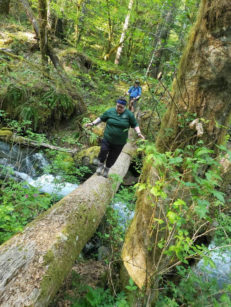
I briefly lost eyesight on the tree and sucked a lung full of air when I could see the white caps of the small stream below me. 1. 2. 3. 4. I started counting. 5. 6. 7. Finally, at like step 22ish, I made it across.
I took in a gasp of air, and I couldn’t hold my tears in. That was both the most frightening thing I have EVER done, and the most unbelievably badass thing I have EVER done.
We took an impromptu snack and water break here. My friends congratulated me. And that was the moment I realized just how incredibly important these 3 humans are to me. I would have turned right around 4 years ago. I would have inch wormed my way back to the road and gone home if needed
After fording a couple of more streams and creeks that are too small to be named and popping a Bloks Energy Chew by Clif, we finally arrived at an unsuitable camp spot, but I would have appreciated the heck out of my favorite 4.5″ thick sleep pad.
I was done. So done. I was a big ball of sweat. I was chafing in unmentionable places. The balls of my feet were screaming to be let out. I was miserable.
When I finally decided to stand up and find a secluded place to pee on the other side of the tree I fell down in front of, Scrambles and the Spoose returned full of excitement and energetic glee.
“We found it! The epic spot is South JUST .21miles.”
Epic spot? Heck. Yes.
.21 miles? Nooooooooooooooooooooo.
Fine.
729pm
Excerpt from my journal: “I am currently sitting on my sleep pad, in my set up tent, contemplating standing up and joining the others on the cliff side. I am glad I am not afraid of heights. And I am glad/so thankful that scrambles and the spoose is here to help get water and provide cheer support. Seriously.
I have pushed myself far beyond anything I have ever done….I freaking made it.
I have no idea what tomorrow will be if I am on the struggle bus by the time we get back to the road. I will be OK with walking the road to the car. That will be part of my experience and I am OK with that….the goal is to finish and HYOH and safety.
If my body cannot do all the trail back, that’s OK…I need to put my safety first. With that being said, I am going to sleep well tonight…time to eat!
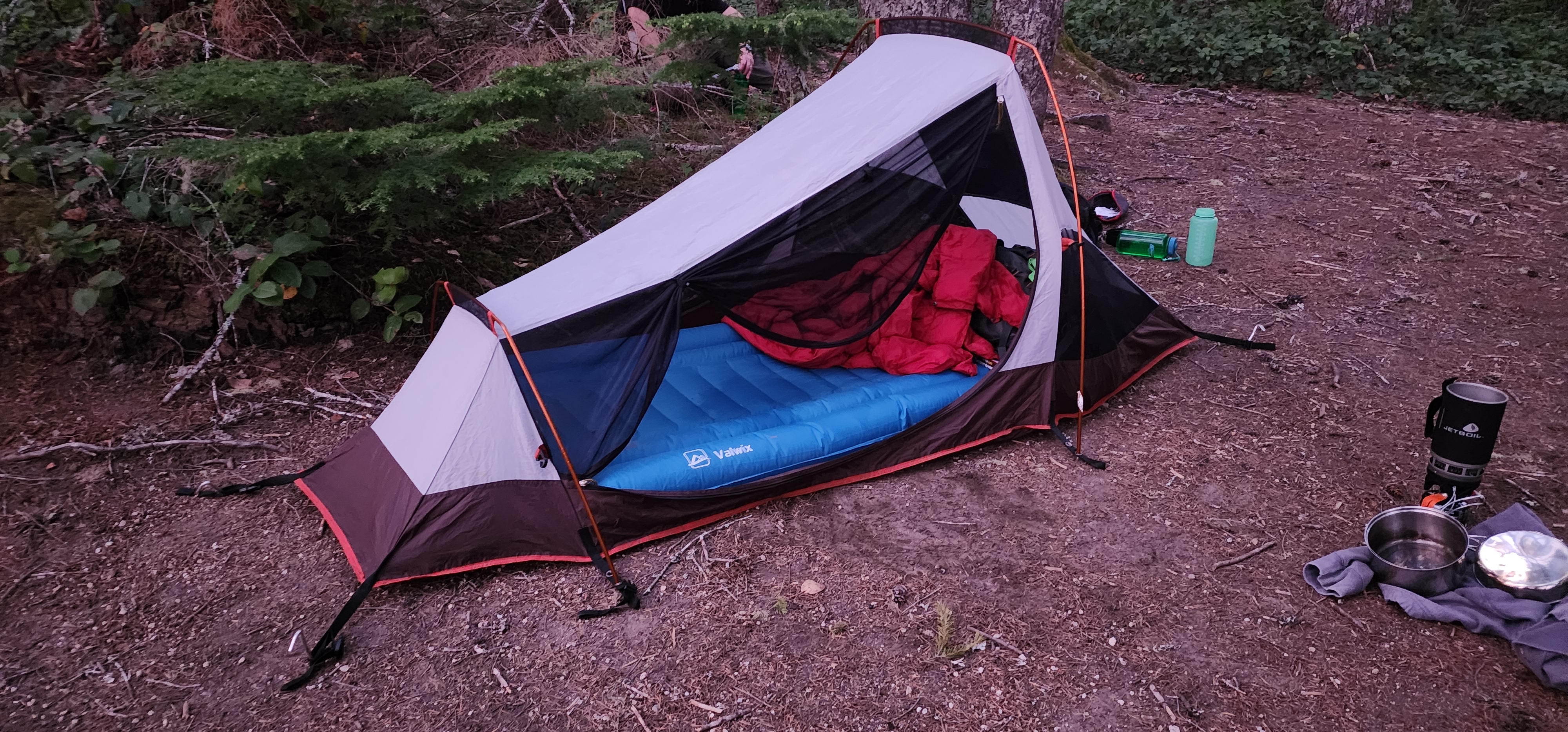


And boy, did I sleep WELL. I fell asleep at 9:35pm and was out until 8:28am (Fitbit tracked). 11 hours. It was glorious.
Also, this sweet pork & rice premium freeze-dried backpacking meal from Peak ReFuel was AH-MAZING. A week later and I am still salivating over it.
It does come with 2 servings, and because I could barely eat half of it, I was able to eat the rest for breakfast Saturday morning. In all honesty, I probably would have purposefully saved half for the next day’s lunch, because YUM.
But, the spot we ended up sleeping at, was definitely an EPIC spot. Even the memorial of a cool mountain biker named Ed Stone laid where Bowline set his tent up in front of, was fitting.
Ed became our friendly camp ghost. That night, I had a very interesting dream of Ed and all of his family. I can’t remember most of it now, so that will have to be good enough.
I almost fell asleep while waiting for the boiling water rehydrated my food, so the moment I was done eating and put my food in a bag to be hung in a tree away from our camp in the case of bears or cougars, I zipped up my tent, laid down, and passed out.
The sunset was beautiful, and the warmth left from the day made it the perfect night under the stars as I fell asleep to sounds of the roaring Lewis River below us.
Saturday, May 20th, 2023
853am
Excerpt from my journal: “Time for breakfast! Which is actually the rest of dinner…Last night, I had a dream of the ghost that Bowline slept near. I woke up and saw blue sky, then went right back to bed. Now, it is cloudy and chilly.
At some point in the middle of the night, I decided I may be able to do the full trail back instead of part road, but we shall we see. I have a blister in a weird location…and I guess I only packed 1 extra sock, so one sock is damp with sweat and I am chaffing bad…
The place we found to camp for the night is right next to the trail. But, based on how unmaintained this trail is, ain’t no one coming this way except for the 2 strangers we came across yesterday before The Log that told us of this spot. And, right now, 2 people [just] passed us.”

After re-reading my research for this log, and now that I am not beyond exhausted, I realize now just how amazing it was to sleep on a cliff that was probably slept on 6,000 years ago by the earliest Native Americans, shaped by glaciers during the ice age 13,000 years ago, and formed from 400K+ years of volcanic material.
I am just a speck of sand. We spend just moments on this Earth. But the land we travel has been around for millions of years and will continue existing far past us. That’s just wild to me.
But, I do find it interesting that I do not feel that same wildness sitting in my home. Very interesting indeed.
I wonder if Indigenous tribes that inhabited this area long before settlers had the same amazement at this same land. Or if it was just home to them. Lewis River, full of wild salmon, rainbow trout, and whitefish, was central to their survival. But were the mountains, the forests, the rolling hills just as recharging for their soul as it is to someone who visits from their concrete jungle?
Things I thought about on the trail and while writing this log.
1232pm
Excerpt from my journal: “We left camp at about 1015am. We have walked nearly nonstop for 4.58mi and have stopped at the same spot we did yesterday to refill water at LF CG.”
Side note: I loved this little river access spot. It was the only dedicated river access spot with a ramp down to the shore and not just a million stairs (Ok, maybe like 10). Perfect for accessibility AND for backpackers who just can’t lift their feet any higher.
“My legs hurt and I am breathing hard today, but I crossed The Log again (bc I didn’t have a choice). Almost slipped at the very beginning.”
My life flashed before my eyes in that second that lasted an eternity.
“Now that we are at Lower Falls, I can make it to Middle Falls. There is a TH to the road there. This last portion is going to be hill and up. I keep thinking about the indigenous people traversing this land and I am amazed.
I am one big ball of sweat. We have passed alot of day hikers, and I have a whole new appreciation of everything and everybody.”
At this spot, my friends and I got to talking about the tricks we play to keep us going. Scrambles mentioned how endurance athletes are more successful if they set little goals, like getting to the next street, and then the next – versus making one goal: reaching the end.
After we left this spot and continued on our way, I kept thinking about what she said.
The power of psychological warfare is astounding. I was making these escape plans because they were little goals I could keep pushing for, keep myself motivated for.
“This place is popular on a beautiful weekend. 1/2 way done. Well, 3/4 done. 1/2 today.
Dr. Pepper, Chicken Sausage, and a chocolate muffin waiting for me.
This trail will come to an end. And then I don’t want to see boots or a hill for at least a week.”
When we got back to the Crab Creek TH – there were at least 20 cars parked.
p.s. it wasn’t until after the next stop that Scrambles reminded me that I also had my Chaco’s waiting for me back at the car, too.
245pm
Excerpt from my journal: “8.57mi-ish. Stopping below Upper Falls for a snack and recharge. All that is left is the hill I had trouble with coming down.”
Between the last stop and this stop, we traversed those “very narrow, sketchy sections, where one step would equal an untimely demise” again that I mentioned earlier.
While I listened to the music of the river reverberate off the cliffsides at each of those untimely demise sections, my legs were getting tired. I was starting to make careless mistakes. Bowline was my hero. He let me use one of his poles for the rest of the journey.
But, at this stop, I realized I had no more escape plans. I HAD to get through the remaining couple of miles. And that included climbing up – and surviving – that first tricky down hill spot.
“My feet hurt, or rather, the bottoms of my toes. That’s the only thing currently hurts. But the cool breeze coming off this falls is magnificent. And the reverberation from the eriver bouncing off the canyon rock edges walls (I stopped making sense) we traversed – beautiful.
Time for snacks, water, and to dig deep to get to the end. Dang. I’m doing the thing.”
Yes, Beast, you are doing the thing. Little does 245pm you know that this next section will finally prove to you just how much of a badass beast you are and the strength of your Beast Mode.
4pm
Excerpt from my journal: “9.4ish miles. ALL DONE. My feet hurt and it is time to go home.”
That was the full entry.
What I had zero energy to include, was the puke break I asked for after climbing up that very tricky down hill spot.
At one point, we stopped in a very tiny flat spot because there was a very warm air pocket that was only maybe 3 feet wide. Cold – warm – cold.
I had noticed this phenomenon in other places on the trail. But mostly only when the trail had turned inwards to land and away from the river. Feeling that warm air bubble in that specific spot was oddly strange and someone much smarter than me will understand the science behind that.
I also noticed how, when you travel inland more than 10 feet away from the river, it gets quieter and quieter. And warmer. But around 100 feet away from the river and you can barely here it.
Oh, and, on this day, I thoroughly enjoyed the fact that whenever a river or stream merged with the Lewis River, the slight breeze that the merge created was very welcoming.
Every step I took up that cliff edge, I got closer to being on my hands and knees to ascend. At one point, Scrambles gave me a hand to help pull me up a spot my legs just wouldn’t lift higher for or stand strong without help.
I may not have actually puked. But I may have redacted my memories of the trail from there until the Upper Falls.
My feet were just moving on autopilot at this point. I couldn’t form words. I couldn’t go any faster. My feet just stepped one in front of the other out of pure willpower to get to the end.
My little internal chant may have helped too: “Chaco’s Chaco’s Chaco’s Chocolate Muffin. Chaco’s Chaco’s Chaco’s Chic-ken Sausage. Chaco’s Chaco’s Chaco’s Dr. Pepper. Chaco’s Chocolate Muffin Chic-ken Sausage Dr. pepper M&Ms. But do I want to chug my Dr. Pepper or sip it slowly? Definitely chug. I brought 6.”
And that is how I made it across the finish line. With the knowledge that the taste of Dr. Pepper, the comfort of my Chaco’s, the sweetness of M&M’s and Chocolate Muffins, and the fuel of Chicken Sausages were waiting for me. I just needed to make it.
854pm
Excerpt from my journal: “Sitting in bed…I am chafing, my butt hurts, my blister on the back of my left foot is HUGE…and I am questioning who I am and why I do this to myself. Yet, already thinking of the Rover BP trip in June.”
That first night back in my bed was a rough night. I definitely learned I need better fitting clothes and moisture wicking socks.
“I had fun and pushed myself. Being in nature, amongst birds and river sounds and roaring waterfalls and cobwebs and snags and ancient trees and trees growing from dead nurse logs, it was good for the soul.”
I may have pushed my body to the extremes, but my soul needed this adventure. It has been dreaming of this adventure for 4 years. But I am glad it took me 4 years to get here because my soul wasn’t ready until now.
“Scouter Bowline was amazing and I am so glad I [got] to know him and the spoose was such a huge help. I couldn’t have done this without them and their moral support and water support and pole support and hands to steady me and guidance on ways to cross.
[I did] things I should have learned as a kid but never had access to OR the body for, or rather, the belief in myself.”
The next day, Sunday, May 21st, 2023, before the regularly planned all-section meeting, I wrote in my scout journal that “it is finally sinking in that the 16miler was not, in fact, a dream.”
A week later, and it is still sinking in.
P.s. On our way home, we stopped at a light, and the store to our right was called “Letterbox”. Scrambles, Bowline, and I laughed. The spoose didn’t get the inside joke. But long story short – we attempted to find some letterboxes at our local park so we could practice map and compass skills. It was an epic failure in the sense that we didn’t find a single one. But it was a success because we learned so many lessons that day. Like, how NOT to provide directions. Hint: Subjective directions such as “Turn right when you get to the funny-looking tree” – is not helpful. Like, at all.

What I learned
- The value of good friendships.
- The importance of making sure you have 2 extra socks and not 1.
- Invest in backpacking food you actually like. For example, I am so done with peanut butter tortillas, but I will eat all the Sweet Pork & Rice’s.
- Don’t trust your GPS, any trackers, or mileage on any signs. And only kind of rely on points of interest.
- Take the dang hiking poles. Even if you think you won’t use them, just. take. them. Or hope you have your very own Bowline with you.
- I can officially do whatever I put my mind to. Ok, so I have always been able to do whatever I put my mind too. But this sealed the deal. I have NEVER done anything this strenuous, this hard, this huge.
- That I can survive, if I absolutely had to, on my own.
Background: A Tale of 2 Histories
Side note: I am going to have to create a TLDR version of my log because this just keeps going on and on my friends. I am almost done. I promise.
The Lewis River, before it was called Lewis River, was home to the Cowlitz, Yakama, Klickitat, and Chinook people who thrived off the abundant amounts of Salmon running through the river.
On June 9th, 1855, a treaty was agreed to that had the Indigenous people ceding 11.5 million acres to the US while gaining permission to still hunt and fish.
A 3-year long Yakama war (1855 – 1858) was waged between the Yakama Nations and settlers after Washington’s governor reneged 2 weeks after agreeing to the treaty that gave the tribes 2 years to relocate.
The reason behind the reneg was because there was an error. The land the Yakama Nation’s reservation was on, was accidentally left out of and not included in the original treaty.
While the war ended, Native Americans in the area still had a hard fight ahead of them to regain stolen territory that lasted over a century. Today, the Cowlitz Indian Tribe and Confederated Bands and Tribes of Yakama Nation still look after the river, but they will never have all of their stolen land returned. Only pieces.
It wasn’t until May 20th, 1972, when President Nixon signed an executive order that returned 21K forest land acres to Yakama Nation. Albeit, 21K acres now part of the Gifford Pinchot National Forest.
As he signed the executive order, Nixon was quoted as saying, “This action rights a wrong going back 65 years. The U.S. Government lost the treaty map in its own files and by the time it was found actions had been taken which had mistakenly displaced the Indians from this land.”
You may be trying to do the math, but 65 years wasn’t 1855 when a 3-year-long war began.
While this executive order was an extremely important declaration and said to be a legendary landmark turning point in returning other stolen land, the land that was stolen was stolen officially back in 1897 when Mt. Rainier Forest Reserve was named as one of the first National Forests in the US by President Grover Cleveland.
And in 1907, President Theodore Roosevelt extended the boundary to include those 21K forest land acres that Nixon gave back.
In 1908, President Roosevelt signed Executive Order 820 and established Columbia National Forest, home to 941K+ acres of forest land that was nearly inaccessible to the public.
But, as Indigenous people continued to use their berry field summer camps to the west of Mt. Adams, more and more settlers arrived.
As they arrived, roads, ferries, and trade routes were created, causing the local tribes to suffer not only healthwise and dying populations due to disease brought over, but also because, little by little, their land was being taken by settlers.
It was clear to Yakama Nation, that to get their land back, they needed to raise leaders that could learn English and English laws so they could fight.
By 1966, after gaining the attention of national media, the Indian Claims Commission declared that the land that was taken, was, in fact, rightfully and legally part of the Yakama Reservation. However, their solution was monetary reimbursement, not returning the land that was taken due to the error.
This pushed tribes to form alliances, leading to national attention and ultimately, to President Nixon’s desk.
While that was happening in the background, Columbia National Forest was renamed, again, in 1949, to what we call it today – Gifford Pinchot National Forest.
Before that, between 1933 and 1942, during the Great Depression, the Civilian Conservation Corp project began, leading to roads, trails, and buildings we enjoy to this day.
Which makes me wonder, if Aldolphus Le Lewes never settled in the area, never became a surveyor, what would have become of this land? What would Gifford Pinchot National Forest and consequently Lewis River Trail, look like today? Would it have stayed Native Land?
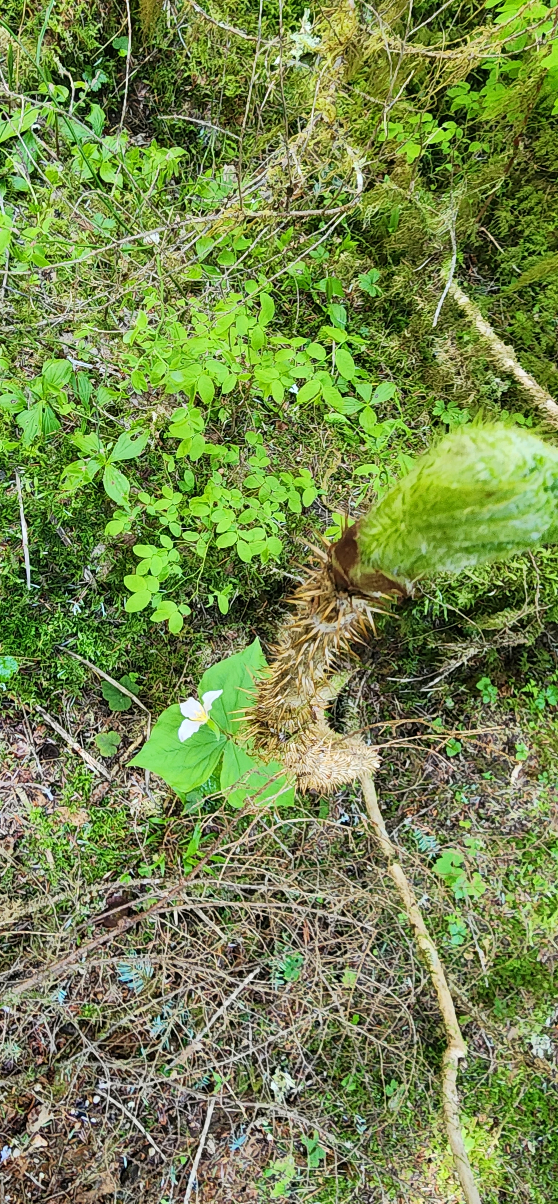
Or would it have been sold to the highest bidder and moss cloaked, old-growth forests of douglas firs, western red cedars, big leaf maples, giant cedars, coralroots, gnome plants, and fields of vanilla leaf – decimated?
There are currently 1200 miles of trails in the GPNF spread across 1.3 million acres, 1,360 miles of streams, and over 100 lakes.
Some of the nation’s first Forest Rangers were stationed in this wilderness. They constructed trails, wagon roads, and ranger stations as they patrolled on horseback daily in fire patrols, taking fire protection seriously.
Prospectors came to GPNF in search of mining in the Spirit Lake / East Fork Lewis River area.
Sheepherders then brought thousands of sheep to the GPNF to forage in the summer. Sometimes in area where tribes had their huckleberry fields.
Loggers lived in camps along the Lewis River to move cut timber easier so they could be milled for houses back east.
And then, it became what we know it today. A place to escape, to relax, to enjoy, to be one with nature. All while the Yakama Nation were pushed further and further away from their home. Their land.
As of now, 60% of Mt. Adams is part of the GPNF and Mt. Adams Wilderness. 40% has been returned to Yakama Indian Reservation.
For 6,000+ years, the earliest Native Americans called this land home. It wasn’t until 1966 when Congress founded the Heritage Program that has helped find, to date, 1,596 resource sites – or sites of antiquities and pieces of history.
All of which are now protected for commercial exploitation and as a way to preserve the forest’s legacy so that anyone and everyone can enjoy the power of the falls, the smog-free air, and the miles upon miles of undulating fields of vanilla leaf, old growth trees, and breathtaking snags.
But, at what cost?
As I traversed a trail possibly built during the Great Depression and stolen from Indigenous tribes, what is my part? I am a descendant of settlers. Am I hurting this land by traveling on it? Or am I enjoying this land as the first people most likely did?
There isn’t an easy answer. As long as I leave no trace, taking only memories, I can only thank the people that came before.
Thank you to the first people who stewarded this land and kept it pristine. Thank you to Gifford Pinchot who saw the beauty of this land and persisted in protecting this land as part of the nation’s first national forest. Thank you to the 250,000 African-American Tree Toppers who left their homes to live in remote work camps to create the GPNF we know today. Thank you to the early female fire lookouts who were our eyes in the trees during World War II.
And thank you to the Yakama Nataions who never gave up fighting for what was right, altering the course of so many tribes that followed in search of getting their land back.
In the meantime, Adventure on with Curiosity,
<> Kelly “Beast” Steele
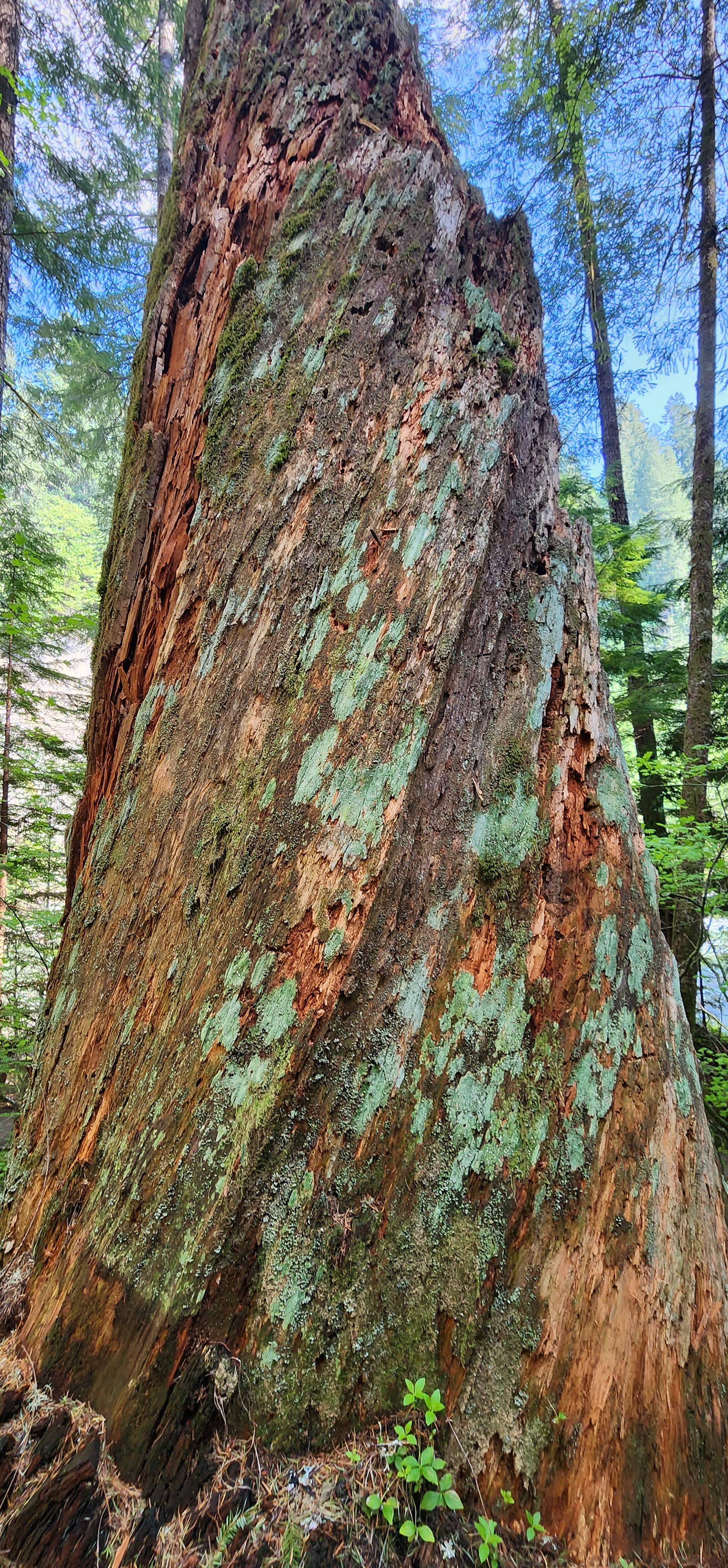
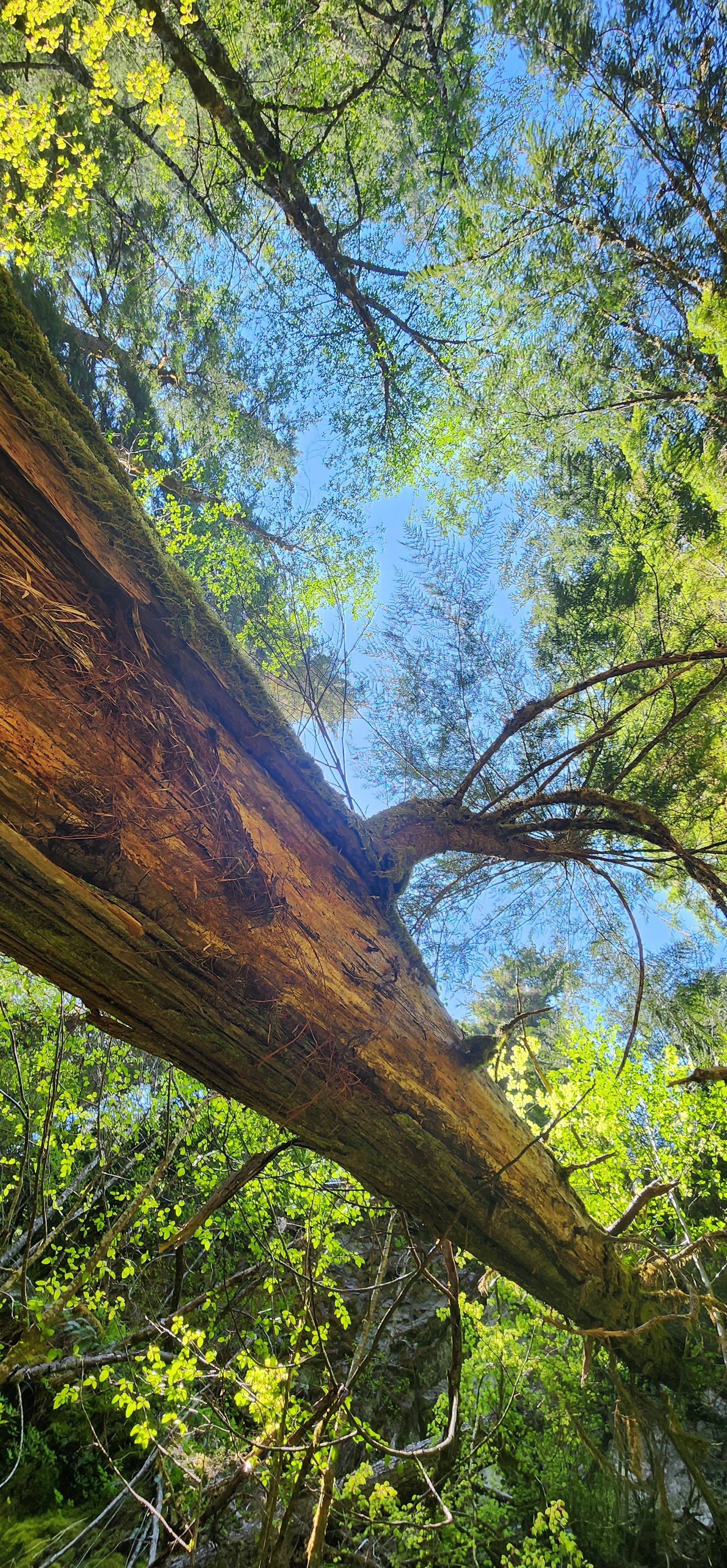
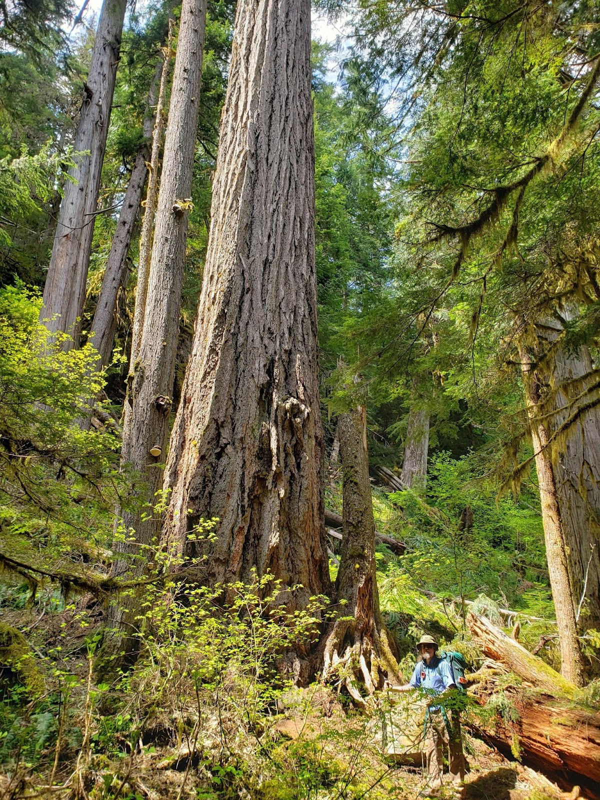
p.s. I can’t believe I forgot to mention the GIANT douglas fir that made us look like ants standing next to it. Holy cow. It was HUGE. Scrambles pointed out that the trees around it were dying or dead, which explains why the Giant douglas fir is so GINORMOUS. It is a water vampire. Of course. This Douglas the Vampire Fir is located within the first mile or two of the trail. My first awe moment of the entire journey. Also, I now must go back to get a panorama of that tree. Shoot. I just realized I didn’t get a good picture of this monstrous beauty. At least it is towards the beginning of the Upper Falls Trailhead.
P.P.S. Living List Experience #26 – 16mi solo (or not) overnight hike – has officially been experienced. DONE!


Leave a comment